
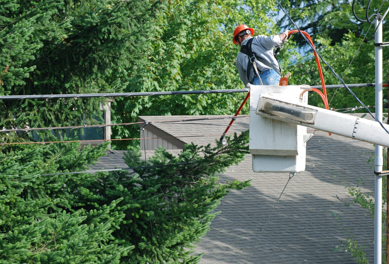
Mighty Span Management Dashboard: Planning, Execution & Reporting
Planning fieldwork is only half the job. The real challenge is staying in control as operations unfold across multiple teams, locations, and changing conditions—while keeping progress and reporting fully up to date.
▶️ In this video, we show how MightyFields dashboards give you real-time control over field team execution, progress, planning, and reporting—so nothing gets missed.
What You Get
From Planning to Full Operational Control
Managing vegetation and span work at scale means constantly balancing plans with reality. Delays, missed spans, or untracked progress can quickly turn into costly risks.
With MightyFields, you don’t just plan the work—you actively control how it’s executed in the field and how it is reported back to the office.
Administrators and managers can instantly:
- Track progress across all teams, locations and jobpacks
- See what’s completed, in progress, or not started
- Detect gaps, delays, and outliers early
- Ensure every span and task is accounted for
- Keep reporting accurate and continuously updated
Instead of reacting after the fact, you stay one step ahead of operations at all times.
Designed for Real-World Field Control
Vegetation span management is dynamic—plans change, teams move, and priorities shift.
That’s why MightyFields dashboards are built to give you:
- A live overview of field activities, not static reports
- The ability to spot inconsistencies and outliers immediately
- Continuous alignment between planning, execution, and reporting
- Full visibility across distributed teams and subcontractors
This means fewer surprises, better coordination, and complete confidence that the job is under control.
Less Administration. Better Reporting.
Manual reporting slows everything down—and still leaves room for errors, blind spots, and missing information.
By digitising progress tracking and field updates, MightyFields:
- Reduces administrative effort significantly
- Eliminates the need for manual status reporting
- Makes reporting faster, clearer, and more reliable
- Ensures all operational data is automatically structured and up to date
- Gives you instant access to trustworthy progress and performance insights
The result: more time managing operations, less time chasing updates and building reports.
Ready to Take Control of Your Span Management Operations?
With MightyFields, you move from reactive oversight to true operational control—live, accurate, and always up to date, from planning and execution to reporting.
and see how it works in your workflow
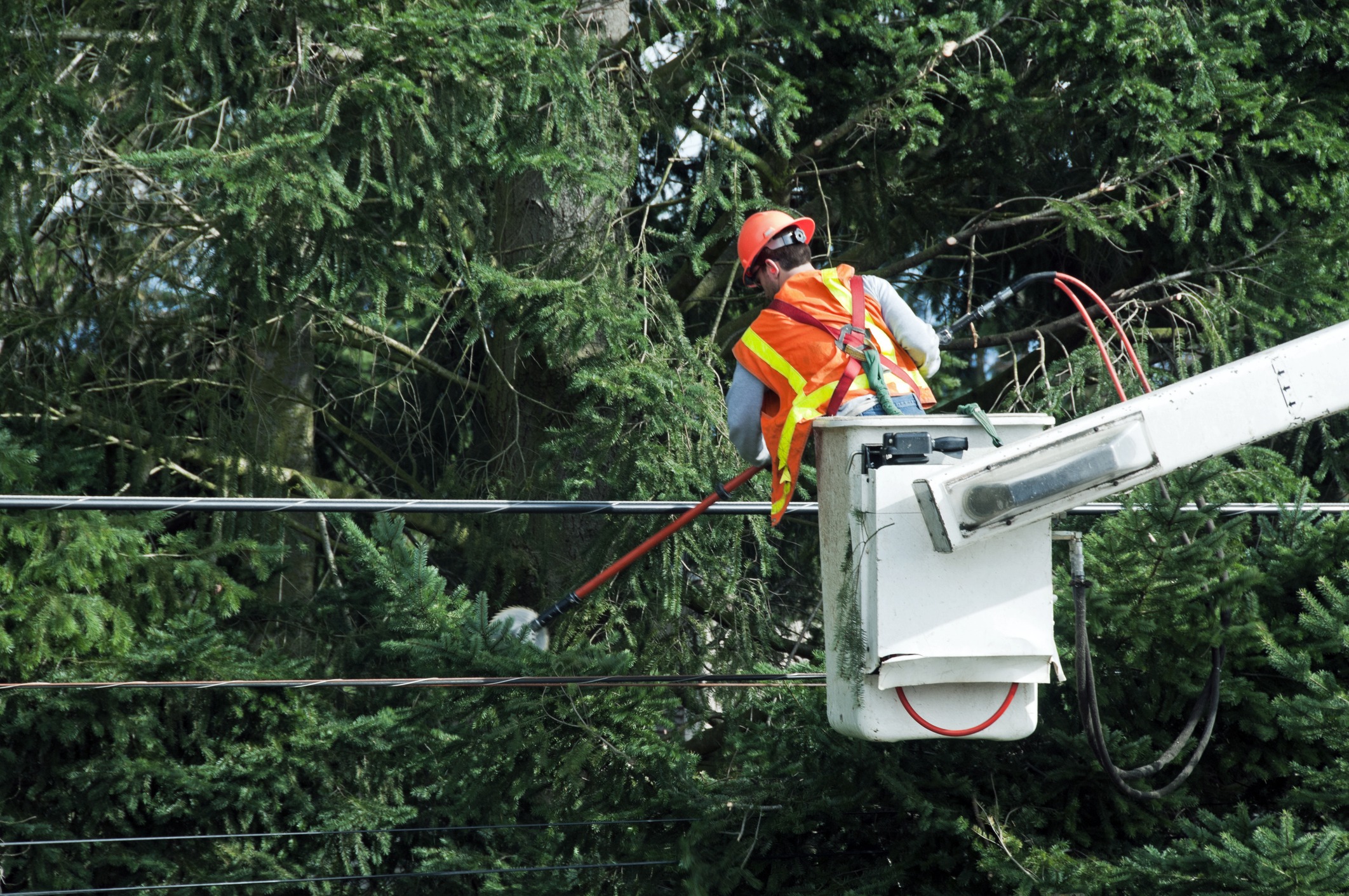
Digital Cutting Operations: From Task to Proof of Work (Video)
Cutting is at the core of your business — and a key driver of revenue.
To maximise efficiency and accuracy, field teams need instant access to reliable information gathered during the on-site survey. Every task must be carried out to the highest safety standards and fully documented, with clear proof of work upon completion.
▶️ In this video, we show how cutting teams execute jobs faster, safer and with complete documentation — from task opening to final proof of work.
Benefits
All Information in One Place – Right at Task Opening
When a cutting team opens a task included in the work package, they immediately access everything they need:
- Span or location details
- A detailed report from the survey stage
- Clear instructions on the required work
No missing information. No delays. Just a structured workflow that keeps teams moving.
“Subcontractors love the mobile app because they have all the information available, do not lose time for administration, and get paid for the job much faster.”
Jakob Halbauer, Calo.sol
Built-In Risk Assessment and Safety Controls
Safety is embedded directly into the process — not handled separately.
The Digital Cut Form includes a pre-populated risk assessment created during the survey stage. Field teams can review, amend or expand it based on real site conditions. Control measures and safety guidelines are automatically provided, helping ensure consistent and compliant execution every time.
Visual Documentation That Proves the Work
Accurate field documentation ensures transparency and accountability.
Cutting teams capture photos before and after the work, providing clear visual proof of completion. This creates a reliable record of site conditions and eliminates uncertainty for managers and clients.

Designed for the Industry: Digital Surveys That Actually Work (Video)
Vegetation management isn’t generic work — and generic tools often fall short. When field information isn’t captured clearly and consistently, operational risk increases and follow-up work becomes harder than it should be.
▶️ In this video, we show how purpose-built digital surveys for vegetation management make it easy to capture the right information — from surveys and consent to risk and environmental assessments — all in one form.
Designed for Real-World Fieldwork
Fieldwork doesn’t happen at a desk — and data collection shouldn’t be designed as if it does. When tools fail to match real working conditions, teams lose time, information gets distorted, and critical details fall through the cracks.
MightyFields surveys are built around how fieldwork actually happens. Open a form on your phone or tablet and you’re guided through exactly what needs to be captured, in the right order, at the right moment — even when you’re offline.
What Makes MightyFields Surveys Different
Guided forms that make it easy to capture the right information every time
Carefully selected field types for fast and accurate data capture
Built-in validation to prevent incomplete or incorrect surveys
Rich data capture, combining written data with photos and signatures
Adaptive forms that change dynamically based on survey responses
Multiple paper forms combined into one simple digital survey
Ready to see it in action?
and see how MightyFields simplifies field data collection.

Turn Excel Work Packs into Field Tasks in Seconds (Video)
Easily import Excel files with DNO work orders and instantly assign them to your field teams using MightyFields
Watch how MightyFields transforms DNO work pack files into ready-to-go field tasks in just a few clicks. Upload, group spans, assign surveyors — and the work is instantly available on their mobile devices for efficient execution. Click play and turn on the sound!
What You Gain with MightyFields
Smooth import of Excel-based work orders
Easy bulk assignment to surveyors (and cutters)
Full control and visibility over field tasks
Mobile-ready for offline use in the field
Ready to Work Smarter?
If you’re still using manual steps to assign DNO work packs, it’s time to simplify.
Switch to a tool purpose-built for vegetation management under overhead power lines.
and see how fast you can go from Excel to Cut.

Why MightyFields Is Replacing Generic Field Tools in Vegetation Management
MightyFields vs. Generic Field Tools
Key Considerations
MightyFields
Generic Field Tools
Setup time
Ready to use from day one
Weeks or months of setup and adjustments
Workflow customization
Out-of-the-box
Needs full customization
Cost of customisation
Included in the package
High and ongoing
Internal IT resources needed
None
High and ongoing
Real-world use cases supported
Span-specific (shutdowns, refusals, multiple landowners, reactive cuts, …)
Limited or missing
Platform updates
Span management specific features
Generic, diluted across industries
Subcontractor onboarding
Instant, self-guided
Complex, training required
Support
Domain experts
Generic, Tool-centric
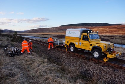
Managing vegetation around powerlines isn’t just another field process. It’s high-volume, high-pressure, and packed with complexity—multiple landowners per span, reactive cuts, consents, risk assessments, and shutdowns. Often in areas with no internet.
Yet many teams still rely on generic field platforms that weren’t built for this work.
The result? Too much setup, too little flexibility—and constant compromises.
That’s why companies like BTS Group, Scottish Woodlands, TreeSmiths, Smerdon Tree Services an others have moved to MightyFields—a platform built specifically for span vegetation management.
Built for Real-World Span Clearance
Generic tools try to cover everything: inspections, maintenance, delivery. But vegetation management has its own challenges. MightyFields was designed for them.
Multi-landowner spans
Shutdown scheduling
Reactive (emergency) cuts
Full lifecycle: quick survey → survey → cut
No workarounds. No coding. Just results.

Ready to Use — Out-of-the box
Generic tools demand months of setup and internal IT just to get the basics working. MightyFields is ready from day one—with the workflows you need already built in.
No delays
No IT teams
No expensive trial-and-error
No risk of data gaps
You start with a tool that fits your field operations—because it was built for them.
Onboard Teams in Minutes not Weeks
MightyFields is made for fast, frictionless onboarding. Teams simply download the app and get to work—no training needed.
Clear, guided workflows
Offline functionality
Consistent, standardised processes
“Our subcontractors are up and running in a day. No issues. No complaints.“
Gavin Mitchell, BTS Group

A Dashboard That Matches Your Process
Forget static task lists. The MightyFields dashboard is built to manage the entire span lifecycle.
Live status across quick survey, survey, and cut
Visibility across internal teams and subcontractors
Real-time updates and task reassignmen
Zero blind spots

Crystal-Clear Work Documentation
No more confusion. Field teams capture what’s agreed on-site—visually and accurately.
Marked spans and notes
Visual sketches in-app
Shared clarity between landowners and cutting teams

Always Evolving for Your Industry
Where generic tools push “one-size-fits-all” updates, MightyFields evolves with vegetation management needs only. Every feature, every improvement—built to make your field teams faster, safer, and smarter.
We Speak Vegetation Management
We understand your work, your workflows, and your challenges. You won’t have to explain what a span is—or why offline access matters.
You’re not just buying a tool. You’re gaining a partner who gets it.
Ready to Take Control?
If you’re still adapting a tool that wasn’t built for vegetation management, it’s time to upgrade.
MightyFields is already working—out of the box—for teams like yours.
and see how fast your operations can move forward.
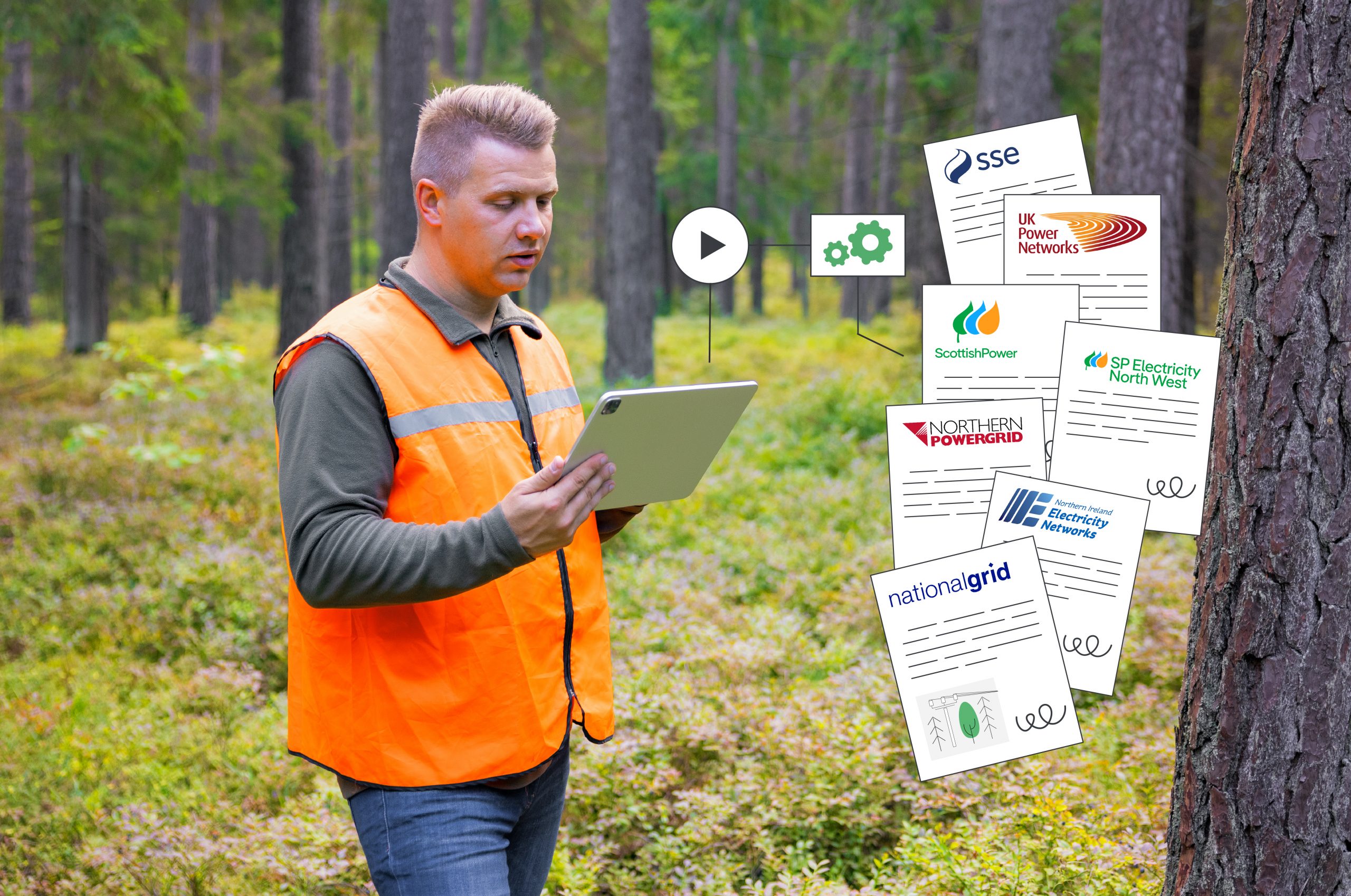
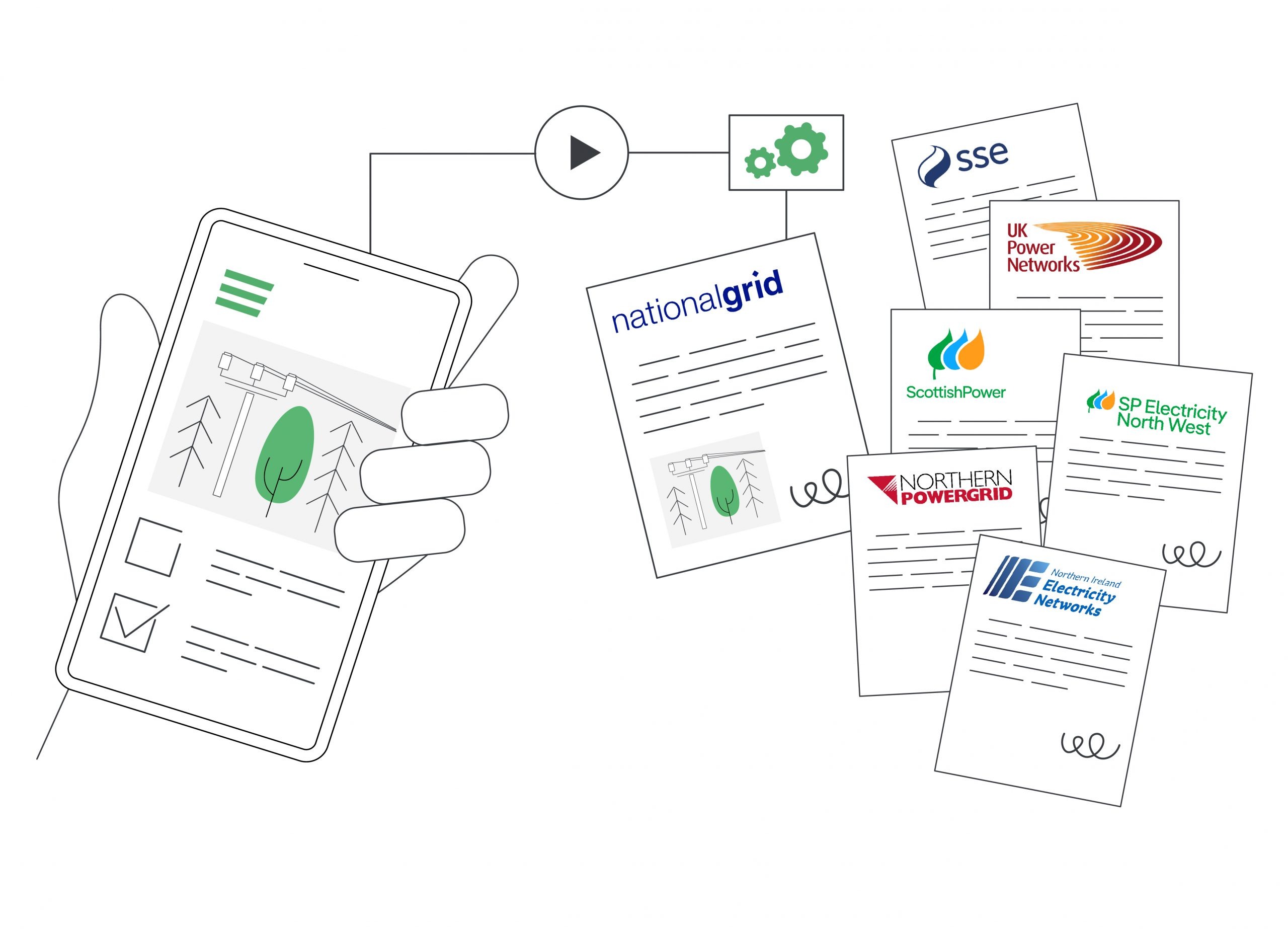
Seamless Vegetation Management for Multiple DNOs
Meet every DNO’s requirements with one adaptable workflow, ensuring accuracy, compliance, and consistency across operations.
Vegetation management contractors are often tasked with delivering services across multiple Distribution Network Operators (DNOs). While this creates business opportunities, it also brings a major challenge: every client has different reporting requirements, documentation standards, and compliance needs.
Managing these differences can quickly become overwhelming. Field teams are burdened with multiple forms, office teams spend hours preparing reports, and administration becomes a heavy overhead — all while inconsistencies risk damaging client trust.
This is where a flexible, field-first digital solution makes the difference.

Flexibility to meet every client’s requirements
Each DNO has its own reporting requirements — and those requirements change over time. With MightyFields Vegetation Management, you can adapt seamlessly. If a client decides to collect additional data points, your workflows update instantly without disrupting ongoing operations.
“MightyFields has given us the flexibility to meet diverse client requirements while ensuring safety and efficiency across our operations.“
Danielle Dunnagan, Scottish Woodlands, Utilities GIS and IT Manager

One Survey/Cut → Multiple Branded Documents
Take the survey or cutting stage as an example. Each DNO may require slightly different information, but with MightyFields, field teams use a single digital workflow that dynamically adapts to the requirements of each client. The app guides them step by step, ensuring the right data is collected every time — whether it’s during a quick inspection, survey or a cutting operation.
From this one workflow, all the necessary reports and documents are generated automatically. And importantly, each document is fully branded to the specific client — complete with their logo, layout, and formatting preferences. This ensures that every DNO receives reporting in the exact style they expect, while contractors eliminate the burden of manually creating multiple document versions.
One survey or cut in the field. Multiple client-branded documents out.
LiDAR or No LiDAR input — You’re covered
Each DNO approaches vegetation management differently, which means contractors often need to adjust their workflows to match each client’s process. With MightyFields Vegetation Management, these differences are handled effortlessly. The solution supports three main operational stages — Speed Survey/Inspection, Survey, and Cut — and automatically adjusts to the data and requirements received from each DNO.
For example, some DNOs provide contractors with LiDAR data that already identifies the spans requiring attention. In such cases, the Speed Survey/Inspection phase can be skipped, and teams proceed directly to Survey and Cut. MightyFields ensures that for every contract, vegetation management companies have the right predefined workflow, tailored to the DNO’s specific data inputs and reporting standards — all within one unified platform.
Easy onboarding for internal and subcontracted teams
Thanks to an intuitive user experience and guided workflows, vegetation management companies can onboard new internal or subcontracted crews instantly. No training is required — teams simply pick up the mobile app and start working safely and correctly, regardless of which DNO’s requirements apply.
Our subcontractors are up and running in a day, with no extra help, just using MightyFields. The app guides them step-by-step, ensuring data is collected accurately every time. We haven’t heard a single complaint from the field—if it wasn’t working flawlessly, we definitely would have.
Gavin Mitchell, Business Information Manager, BTS Group
The Result
Vegetation contractors can simplify operations, reduce reporting headaches, and strengthen client relationships by meeting every DNO’s requirements consistently and accurately. With MightyFields Vegetation Management, what once felt like a complex patchwork of forms, reports, and administration becomes a single, streamlined process — with full visibility of span visits and progress — for both the office and the field.

Accurate data from the field: The Missing Link in Smarter Vegetation and Span Management
Every year, unmanaged vegetation costs utilities millions in outages and maintenance. While satellites and AI promise smarter solutions, their success depends on something much more basic: accurate field data.
The energy sector is investing heavily in new technologies like satellite imagery and artificial intelligence (AI) to make vegetation and span management more effective and reliable. These tools can pinpoint risks, predict growth cycles, and optimise cutting schedules.
But there’s a catch: the accuracy of these models depends on the quality of the data they’re built on. As the saying goes, garbage in, garbage out. Even the most advanced imagery and analytics are only as good as the ground-truth data they rely on. Without it, the outputs can mislead decision-makers and undermine investments in innovation.
For many utilities, a significant share of vegetation management is delivered by subcontractors. While outsourcing increases flexibility and scale, it also introduces challenges:
Data captured in the field may be inconsistent across providers,
Reporting formats vary, creating gaps in oversight,
Decision-makers lack confidence that the collected data truly reflect the situation on the ground, and therefore also doubt the reliability of the derived analyses and predictions.
The result? Risk of unnecessary site visits, inefficient cutting cycles, or worse — outages that could have been prevented.
That’s why it’s critical that field teams collect complete, accurate data — but without adding unnecessary administrative burden. Crews need to focus on getting the job done safely and effectively, not wrestling with complex reporting tools.
How MightyFields Bridges the Data Gap
With over 8 years of experience working side by side with field teams, we’ve learned that generic solutions, retrofitted for vegetation management, rarely succeed. Instead, systems must be designed specifically for the field experience: intuitive, efficient, and aligned with how teams actually work.
When that happens, utilities can:
Ensure consistency across all service providers,
Build trusted, auditable records of inspections and trimming,
Integrate field insights with satellite imagery and AI models,
Make smarter, more reliable decisions at the span level.
Utilities already using MightyFields have seen these benefits in action:
“MightyFields has revolutionised our operations. Our clients love the timely, well-structured data delivered directly to their systems—it’s elevated our service quality significantly.”
Gavin Mitchell, Business Information Manager, BTS Group – Subcontractor for National Grid and UK Power Networks
In other words, the future of vegetation and span management isn’t just about satellites and algorithms — it’s about linking those innovations with reliable, easy-to-capture ground-truth data.

Simplicity Is Key to Compliance in Span Vegetation Management
In the world of span vegetation management, compliance isn’t optional—it’s a daily priority. From ensuring health and safety regulations are met to keeping detailed records for environmental and legal standards, there’s a lot at stake.
But here’s the thing: compliance doesn’t have to be complicated. In fact, the simpler it is for field teams to record their work, the more likely they are to get it right.
Whether teams are surveying, cutting vegetation, or auditing completed work, they’re often operating in remote locations, sometimes with no internet connection. Add unpredictable weather, tricky terrain, and strict safety checks into the mix, and it’s clear—simplicity on-site is non-negotiable.
That’s why tools like MightyFields make such a difference:

By providing an intuitive, easy-to-use interface that works offline and mirrors existing processes, field teams can focus on the job at hand rather than wrestling with technology. From quickly filling out safety checks before cutting near high-speed rail lines to capturing rich data like photos and videos on-site, simplicity ensures the job gets done—safely, accurately, and compliantly.
At the end of the day, compliance depends on accurate records. And accurate records depend on making it easy for teams to collect data in the field. Keep it simple, and compliance follows.
use case
Scottish Woodlands Example
As one of the leading vegetation management companies in the UK, their teams work across railways, power lines, and ecological sites—often in challenging, remote environments.
With MightyFields, they streamlined their processes, ensuring field teams could easily record critical safety checks and compliance data, even without a signal.
Danielle Dunnagan, Scottish Woodlands’ digitalization lead, highlighted how essential it is simplicity in the transition to digital:
“It’s essential that our reports match the existing paper forms our teams are familiar with. This simplifies the transition to digital and makes it much easier for our field teams to adopt the new system.”
Today, Scottish Woodlands runs everything from railway clearance to ecology compliance checks through MightyFields, ensuring full compliance while reducing administration time.
Real-Time Calculations That Keep You Safe in Span Vegetation Management
In span vegetation management, safety isn’t just a priority—it’s everything. Whether surveying a span or preparing for a vegetation cut, one wrong move can lead to serious safety risks, costly shutdowns, or non-compliance with strict regulations.
That’s where MightyFields steps in. One of its most powerful features is real-time calculations built directly into the digital forms. As your teams fill out key data during a survey or before cutting, MightyFields thinks for you—automatically calculating whether it’s safe to proceed or if the line needs to be shut down before work can continue.
No Guesswork, Just Clear Guidance
There’s no room for uncertainty in the field. MightyFields gives your team instant feedback:
Safe to Cut? Proceed.
Shutdown Required? Notify and Schedule.
This removes the need for workers to make complex, on-the-spot decisions or rely on paperwork that might not reflect real-time conditions. The system interprets the data and instantly provides clear, actionable guidance based on pre-set safety parameters and regulations.
demo
How It Works
As the team fills out the required data— noting vegetation heights, distances from the line, identifying risk zones and more—and MightyFields runs the numbers behind the scenes.
The result? Instant answers about operational safety.

Why It Matters
Protects Your Teams: Field workers know immediately if the task is safe to proceed, reducing risk and preventing accidents.
Ensures Compliance: Decisions are based on pre-defined rules and regulatory standards, ensuring every action taken meets legal and safety obligations.
Saves Time and Money: Avoid unnecessary shutdowns—or worse, unplanned outages—by making informed decisions on-site.
Supports Real-World Conditions: MightyFields works offline, so even in remote areas without signal, your teams can rely on accurate calculations and guidance.
Scottish Woodlands uses this feature to great effect. Their teams often work near high-voltage lines and fast-moving trains. Instant feedback from MightyFields gives them the confidence and clarity they need to keep their people safe and operations smooth.
Scottish Woodlands & MightyFields
Scottish Woodlands Success Story
Expanding Digital Transformation with MightyFields
From Span Management to Multi-Process Digitalization
Scottish Woodlands, a leader in vegetation management and environmental compliance, has been using MightyFields to streamline its operations. Initially adopting the platform for vegetation management of overhead powerlines under their contract with Scottish Power Energy Networks (SPEN), they have since expanded its use across railway clearance, ecology compliance, and additional infrastructure projects.
Meeting Diverse Needs with Customization
Scottish Woodlands manages vegetation for multiple clients, each with unique requirements. MightyFields enables them to tailor digital forms and workflows to match existing paper-based processes.
“One of the most important aspects of digitalizing our processes was ensuring that our clients’ documents remained unchanged in structure. This way, our transition to digital only improves efficiency without disrupting our client relationships.” – Danielle Dunnagan, GIS and IT Manager at Scottish Woodlands
This flexibility ensures compliance with client specifications while improving efficiency and maintaining seamless collaboration.
A Digital Transformation They Can Own
One of the key advantages Scottish Woodlands has found with MightyFields is the ability to manage their digitalization independently.
“The best thing is that we can handle digitalization in-house. The MightyFields team is incredibly supportive and always willing to maximize the field experience. You can tell they are true experts in building guided field workflows that make processes smoother and more intuitive.” – Danielle Dunnagan, GIS and IT Manager at Scottish Woodlands
With user-friendly customization options, their team can continuously refine and expand the system as needed, ensuring long-term adaptability.
Key Benefits
Reliable Offline Operability – Operating in remote areas without signal is no longer a challenge. Teams can complete reports on-site, and data syncs automatically once connected.
Enhanced Safety Measures – Safety is paramount, especially in railway environments where high-speed trains require rigorous inspection protocols. MightyFields supports safety checks and compliance documentation.
Multi-Process Management – Beyond power line clearance, Scottish Woodlands now leverages MightyFields for railway operations, ecology compliance, and issue management.
Seamless Digital Transition – By replacing manual paperwork with a fully digital system, Scottish Woodlands is driving efficiency and reducing administrative overhead.
The Future: Scaling Further
Scottish Woodlands continues to expand its use of MightyFields across new business areas. The platform’s adaptability is proving instrumental in their mission to provide top-tier vegetation management services while staying ahead in digital transformation.
“MightyFields has given us the flexibility to meet diverse client requirements while ensuring safety and efficiency across our operations.” – Danielle Dunnagan, GIS and IT Manager at Scottish Woodlands